 Loading...
|
On this page
Work information
Title: LinkTool v1.0 — A Natural-Language-Driven GIS Analysis Agent Based on the Model Context Protocol Category: Project Type: GIS Agent / MCP Plugin Focus: Geographic information systems, large language models, MCP protocol, spatial analysis automation Role: Core member At a glance
Zeng Zhun C#, WPF, ArcGIS Pro SDK, MCP Host/Client/Server, RAG, LLM API, Python 2025 Quick links
|
LinkTool v1.0 — A Natural-Language-Driven GIS Analysis Agent Based on the Model Context ProtocolExploring natural-language access to ArcGIS Pro spatial-analysis tools for common GIS workflows. 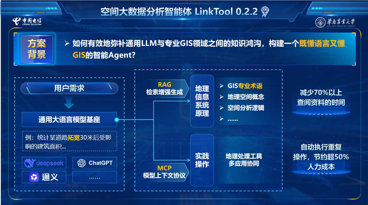
Overview
The project explores natural-language interaction with GIS software through a geospatial analysis agent based on large language models and the MCP protocol. Implemented as a C#/WPF add-in for ArcGIS Pro, LinkTool connects language-model reasoning with local geoprocessing tools and external data services so that users can describe GIS tasks, review the generated plan, and execute the workflow within the familiar desktop environment. Five-layer system architecture
The prototype is organized into UI, Host, Client, Server, and Resource layers. The Dockpane-based UI handles conversation and task display; the MCP Host manages model requests, context, and execution loops; the Client connects to internal and third-party services through SSE or stdio; Servers expose capabilities as Tool, Resource, and Prompt; and the Resource layer covers files, databases, web services, and local computing environments. After the model selects a tool, the Host sends the structured parameters to the corresponding MCP Server and feeds the returned JSON result back into the conversation context. This loop supports planning, execution, inspection, and continuation across multi-step spatial-analysis tasks. Task orchestration and knowledge enhancement
Internal ArcGIS tools are registered through C# reflection, while reusable Prompt templates standardize system instructions, continuation requests, and error handling. The task plan can therefore be revised according to intermediate results instead of being fixed at the first user instruction. A retrieval-augmented knowledge base supplements the model with 1,606 ArcGIS Pro 3.3 tool documents, more than 200 application cases, nearly 1,000 task-planning examples, and about 1,500 tool names and parameter descriptions, improving tool selection and parameter generation for GIS-specific requests. The system can connect to third-party MCP services such as AMap, Bing Search, file-system access, and Python execution, while built-in services expose ArcGIS Pro tool invocation, user-data access, knowledge-base retrieval, and prompt calls. This allows a single task to combine online data, local files, geoprocessing tools, and scripts. Capabilities and execution transparency
LinkTool supports data-querying, spatial-analysis, cartographic, and attribute-editing workflows in the ArcGIS Pro toolbox, with access to local data including Shapefile, CSV, File Geodatabase, and TIFF. For batch tasks beyond standard tools, Python MCP can generate and execute arcpy scripts. Execution remains inspectable through task plans, tool cards, generated parameters, map outputs, and ArcGIS Pro geoprocessing history. Completed workflows can also be exported as geoprocessing models or Python scripts for review and reuse. Case validation
The competition materials document three representative workflows: acquiring route data through AMap and producing material reports with ArcGIS tools, completing a community transport analysis through 39 tool calls, and filtering candidate parcels for soil-survey fieldwork. According to the recorded demonstrations, the route-data workflow took about 10 minutes, compared with about one hour through direct API programming and two to three hours through conventional manual processing; the 39-call community analysis was completed in about 30 minutes. These figures describe the submitted prototype demonstrations rather than a universal performance benchmark. Project results
The project received multiple awards in academic competitions, portions of its core code have been released as open source, and the prototype was presented at the 2025 Digital Intelligence Technology Ecology Conference hosted by China Telecom. |