 Loading...
|
On this page
Work information
Title: Village-Scale Reality 3D Modeling with UAV Photogrammetry — A Case Study of Beigen Village, Zhaoqing Category: Project Type: Geographic information engineering fieldwork / Digital village Focus: UAV photogrammetry, reality 3D, rural roads and POIs, digital villages Role: Core member At a glance
Zeng Zhun UAV oblique imagery, orthophotos, Ovital Map, ArcGIS Pro, 3D modeling, road and parcel vectorization 2026 Quick links
|
Village-Scale Reality 3D Modeling with UAV Photogrammetry — A Case Study of Beigen Village, ZhaoqingCombining UAV photogrammetry, mobile field collection, and GIS processing to organize village spatial data and create a reality 3D model. 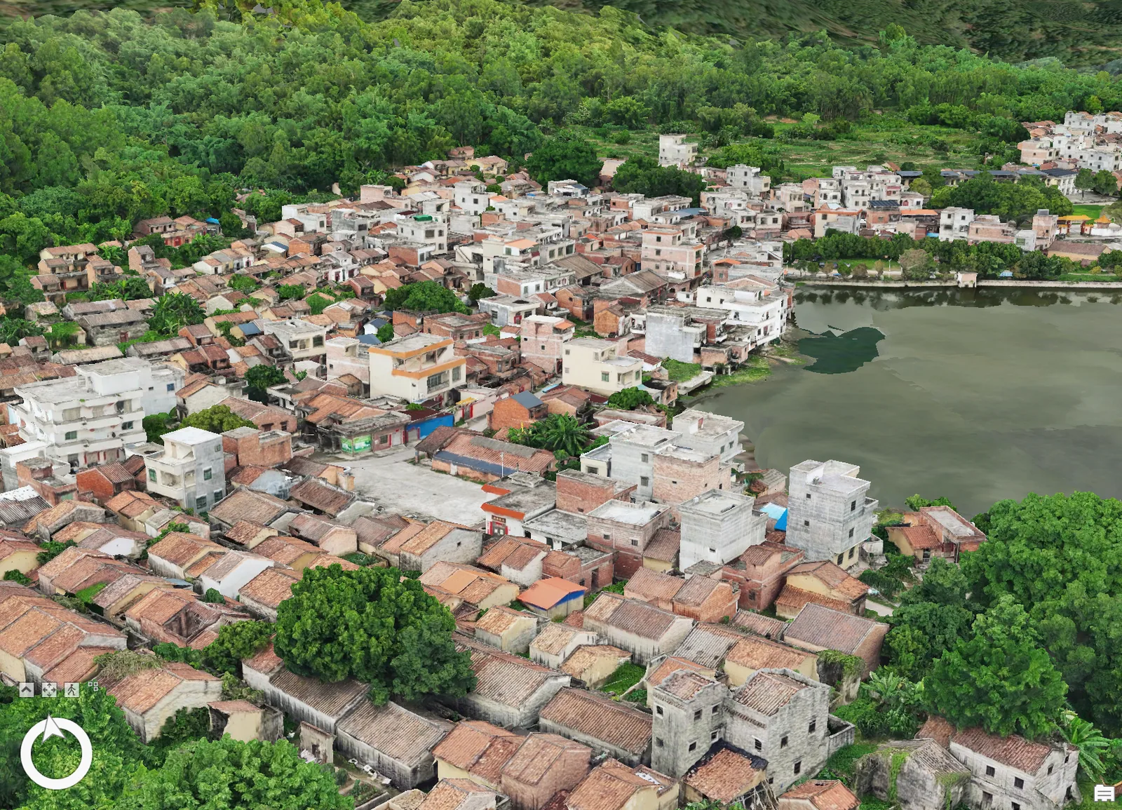
Overview
The project focuses on Beigen Village in Zhaoqing and organizes village-level spatial data through field collection, GIS processing, and reality 3D modeling. The dataset includes remote-sensing imagery, land use, spatial planning, permanent basic farmland, urban development boundaries, roads, and POIs, with additional field information collected for roads, cultivated land, and environmental-management scenarios. Workflow
Initial work defined the study area, UAV routes, and field roles. Oblique imagery was collected over housing and forest areas, nadir imagery over farmland and ponds, while walking, bicycles, and cars were used to survey lanes, embankments, field paths, routes, and key POIs. Indoor processing covered orthophoto mosaicking, 3D reconstruction, road and parcel vectorization, geotagged-photo import, attribute organization, and integration with existing land-survey data into a shared village database. Interim results
The project produced a reality 3D model, orthophotos, a road network, POIs, parcel data, and other interim outputs, and discussed possible applications through a paired practice initiative under Guangdong's High-Quality Development Project for Counties, Towns and Villages. The current outputs are intended mainly for village visualization and follow-up spatial analysis; further applications require continued refinement around village-committee needs. As a practical outcome of the Geographic Information Engineering field course, the project received a score of 96.2 and strong recognition from the course instructor. |